
The majority of the route for this walk is along woodland paths and tracks. The walk can be strenuous in places, with a steep descent at one point to reach Holmbury St Mary and a steady climb after the pubs. The scenery is stunning with the finale being Holmbury Hill Fort, the second highest, after Leith Hill, of the range once known as Little Switzerland. The view has to be one of the finest in the South East and is well worth the effort! This walk is from Friends of the Hurtwood, a registered charity which has the responsibility to raise the funding required to manage public access and protect the Hurtwood environment. For more information and other walks, please visit www.foth.co.uk.
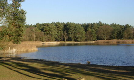
1. To start, from the car park with your back to the road, leave the car park by the main exit past the barrier. Leaving the pond on the right, continue along the broad and sandy path for 100 metres or so. Take small path branching off on left. The banks here are covered with gorse and heather, which puts up a fine show in August. Cross the next two rides (horse riding paths), pass a large pine with a hanging branch (good seat), and just before the path enters a wood, take the countersunk path on right.
2. At the next ride, turn left. Carry on here, past electricity poles, until a small path intersects the ride. Take the right hand arm of this path, through a wooden barrier. Go down a steep wooded bank. Near the bottom, go over a wide crossing path continuing your descent, and you will soon come out onto a driveway to a house on your right. Follow the drive ahead to reach a lane in front of some pretty cottages.
The cottages are part of Holmbury St Mary which, despite its ancient appearance, is essentially a Victorian village. The village church, which you meet further on, was built in 1873 and was designed by GE Street who lived at Holmbury, whose most famous work is the London Law Courts.
3. Carry on down the lane (The Glade) into Holmbury St Mary. You will come into the green and a pub – the Royal Oak (good food – walking parties and dogs on leads welcome). Continue on round the green to the right. Either walk along the road past the Holly Bush, take the right hand fork uphill and reach the Kings Head (beer garden and home cooked meals); or take the right lane up to the church. Turn left at a small parking area and tarmac lane, going up some steps, and fork left following a holly hedge to soon enter a churchyard.
Once in the churchyard, fork right taking the higher path which runs along the top of the churchyard and exit the other side via a wooden gate. After this, follow a narrow path behind some houses and fork left when you meet a pair of electricity poles supporting a mini generator, to shortly meet a lane. Turn right along the lane which will soon lead you to the Kings Head.
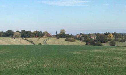
4. From the pub, take the higher lane, Holmbury Hill Road, which runs alongside the green and at the end of the green, turn right (still Holmbury Road). A few paces after, turn right onto a track, signposted to Holmbury St Mary cricket club and follow this uphill past the cricket pitch to its end at a large junction of tracks. Deer are often seen here.
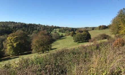
5. Take the first turning on your left, a track marked by a blue GW arrow (the Greensand Way). Sometime later, fork right passing to the right of a wooden footpath post and follow a promising path and where applicable the GW arrows, to eventually reach the top of Holmbury Hill. Holmbury Hill Fort dates from the Iron Age and is one of several along the Greensand ridge. Take time to look at the Toposcope (the panoramic guide to the view), which gives further details about the fort, and other useful information. Rest for a while at the memorial to Reginald Bray (and his brother Jocelyn) who made the public access to Hurtwood possible.
6. On leaving Holmbury Hill, with one’s back to the memorial seat, take the left hand path over a little switchback (part of the iron age fortifications) and follow this path around the edge of the escarpment. There are excellent views, following extensive clearance, of Pitch Hill and the Weald. Pass pond on right, go over little gully to reach car park No 1 our starting point.

DISTANCE: 3 miles
MAP: OS Explorer 145 Guildford & Farnham and OS Explorer 146 Dorking, Box Hill & Reigate
START: Car park 1 in Peaslake. Leave Peaslake on the Radnor Road – the car park is about a mile along on the left hand side. Occasionally the gates to the car park are locked but there is plenty of alternative car parking along the road.


