
This is a lovely walk along a great and unspoilt beach, just perfect for some post-Christmas exercise with the family and dogs. Just one factor that might influence your choice of date: it may be best not to go during a high tide. This is because the shingle on the beach is uncomfortable to walk on but at low or medium tide there is a wide mixed sand-and-pebble strip all the way which is perfectly walkable. To check before you go, try the tide times website at: www.tidetimes.org.uk and click on ‘Worthing’. This walk is taken with permission from www.fancyfreewalks.org.
1. Facing the sea, turn left along the beach. If you go down the shingle you will find a fairly sandy strip and, although there are pebbles here and there, it is quite comfortable to walk on. At low tide, you may find even more sand. If you are walking at high tide, you can make use of a tarmac drive and continue over the dunes. Your first destination is a long breakwater in the distance. It guards the outflow of the River Arun. After a walk of 2km, turn left back up the beach alongside a sea barrier, looking across the river to Littlehampton and its funfair.
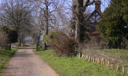
2. Go through a pay-and-display car park and continue near the river. You can either take a concrete lane or go down a strip of sand even closer to the river. If you choose the sandy route, you need to go left-right round a creek by the marina and possibly duck under some boarding ramps, after which you must exit left back to the concrete lane, through the Littlehampton Yacht Club and ferry entrance. Continue along the lane and, where it bears left to the West Beach car park, leave the lane by forking right on a narrow tarmac footpath. There are small sand dunes here and, as a temporary diversion, on your right a footbridge takes you to an islet with a seat, a possible picnic spot. Continue following the high path, passing a creek with several interesting old wrecks, going beside the white Dormy Cottage. You come out to a road. Keep straight ahead along the road, ignoring a footpath on your left. On your right soon is Ruth’s Café, a pleasant outlet with generous sandwiches. At a T-junction, turn right. Straight ahead, but not on your route, is a swing bridge and, on the other side of the Arun you will find two pubs, the Steam Packet and the Arun View, both well regarded for food.
Believe it or not, the River Arun didn’t always reach the sea here. Until the late 1400s it flowed into the River Adur 10 miles to the east. That route got silted up and the river found its own way to form the present estuary during the 1500s.
3. Turn immediately left on a wide tarmac drive for the Littlehampton Marina. In 50m, turn right as indicated, continue straight across the gravel to the riverside and turn left on a grassy path. After several impeccable mobile homes, you pass the Marina and, at a fingerpost, your path veers left across the concrete slipway and then veers right on a tarmac drive, passing the Boat House Café which is noted for its fresh fish. Keep right by some chalets and fork left, as directed by a signpost, through a gravel parking area and through a modern kissing-gate onto a woodland path. As the path quickly winds its way out of the wood close to a road bridge, fork right up a bank onto a higher path, going under the road bridge and rejoining the wide path. Very shortly, before a solid metal fence, turn left as indicated on a rather overgrown path, up a step, over a wooden bridge into a field.
4. Follow the nice clear straight path across the barley field. After 600m, as you enter the next field, the path turns right at a fingerpost. Fork immediately left on a narrower path, avoiding the large metal gate ahead. You have a good view on your right of Arundel Castle and the South Downs. Your path veers left at a fingerpost onto a wide path and comes out, via a large metal gate to a road. Your route is left along the road, but 300m to the right, if you wish to visit, the late 12th / early 13th -century church of St Mary’s Clymping, with many interesting features. Having turned left on the road, using the footway, continue to a roundabout and cross straight over to Crookthorn Lane opposite. (To avoid the barrier, it is best to switch first to the right-hand side.)
5. Just after a thatched cottage, turn right on a byway, passing St Mary’s Clymping Primary School. Ignoring the footpath ahead, turn left opposite the school on a wide track between fields. After 300m, you reach a 4-way signposted junction. If you are not visiting the pub and the village, there is a short cut here: simply keep straight ahead on the track and turn right at the beach, or on a tarmac track, back to the start. Turn right on a nice clear path across the wheat field, continuing on a drive past thatched cottages to a lane. Turn left, immediately reaching the Black Horse Inn, a traditional country pub. After a possible break, continue on the lane, passing some old flint houses of the village and some woodland, arriving back at the beach where the walk began.
Directions:
Arriving at the big Arundel roundabout (via the A29/A284 or the A27), take the minor turning for Ford, Climping. Go 3 miles through Ford, crossing a railway, to a major crossing of the A259 with a roundabout. Turn right on the A259 and, in nearly ½ mile, turn left as for Climping Beach. Park at the end of the lane in the car park. There is a modest charge by ticket, calculated from arrival time. A possible alternative free parking site is Crookthorn Lane, postcode BN17 5QU, with some competition from the school run. An alternative route is via the A24 and Worthing. Follow signs through Littlehampton and, from the A259, look for Climping Beach as above.

DISTANCE: 5 miles
OS MAPS: OS Explorer 121 (Arundel)
STARTING POINT: The walk begins at the Climping Beach car park, near Littlehampton, West Sussex, postcode BN17 5RN.


