
This heritage trail takes in the extensive site of the Gunpowder Works at Chilworth, which boasts possibly the most prominent (and famous) remains of the Tillingbourne mills. Explore not only the gentle series of paths within the Middle and Upper Works, as far as Waterloo Pond, but also the spectacular views from high atop St Martha’s Hill.
1. Start at top of Vera’s Path on the left side of Chilworth C of E Infant School (GU4 8NP), which is next to the Percy Arms pub (point A on the map). Parking on road (A248).
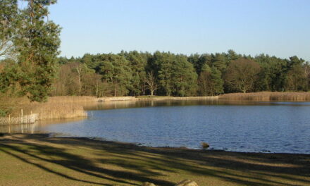
2. Cross over the bridge into the Chilworth Gunpowder Works and picnic area, and follow the path to the right, which follows the old tramway, before veering to the right and running along the edge of the New Cut stream.
3. As you follow the path, you will pass the incorporating mills on your left, which you can go down into and explore. Continue on this path until it reaches the gate (and eastern entrance to the Middle Works). Turn right onto the road, and almost immediately cross the stile on the opposite side, over into the field. Take the small path diagonally across the fields, crossing the stile at the other end.
4. Then cross the second field, following the left side of the ditch. Be aware that horses roam this field. As you look left (in the second field), you will see a row of triangular roofs amongst the trees, which are part of Admiralty cordite works. Cross the small stream at the stile and footbridge, following the path between the fences to Postford Pond. Looking left, you can see a small pond with the remains of more of the works on the far shore.
*Note: This path can become very muddy and impassable in winter. If so, a detour can be made by doubling back to the road by the Middle Works entrance and going south to Lockner Farm and the A248. Follow the A248 west and take the next path north to rejoin the route at Postford Pond*
5. At the road junction at Postford Pond’s corner, turn left and follow around its left side. Note the mill channel on the left as you cross over the water, which belonged to the mill which closed in 1997. Carry on with the pond to your right. As the road continues to Waterloo Pond (bending to the left), take the right path (with the pond on the left and the Tillingbourne on the right).
6. At the road junction (A248), turn left onto the drive signed footpath, past the houses, with the pond on your left (point B). Then take the paved path into a front garden, which is a right of way. Follow the slab path through the garden and past the greenhouse to the back of the garden. Carry on following the path into the woods, over the stile. At the road end, turn right onto the plank path, passing a house on your left.
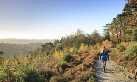
7. Follow the path through the woods, with the Tillingbourne meandering below. This is the site where charcoal was produced. As the path begins to climb up, you will be able to look down to your left onto the Works, through the trees below.
8. Continue as the path climbs steeply up the hill, eventually turning into a sandy track, which will end at a junction at the top. Turn left, and follow the sandy path, passing the WWII pillbox (part of the North Downs defence line of invasion) on your right.
9. As you continue along this path, you will come to the junction of the Downs Link (point E). You can extend the walk and continue along the path to St Martha’s Church and then return back to this point.
10. Turn left down this path and carry on down the hill, taking the permissive path between the fields (the vineyard will be on your left as you continue to descend between the two fences).
11. Go through the gate back into the Gunpowder Works and follow the path over the wooden pack horse bridge. Fork left on the path to the track junction, and then left again, arriving back at the picnic area. As you reach the picnic area, take the right path back to the bridge, crossing over it to return up Vera’s path and the A248.
This walk is the second in the Tillingbourne Trails.
For more information and a larger map, please visit tillingbournetales.co.uk/places/trails/chilworth-trail.
Image: Chilworth Gunpowder Mills (Andy Scott)
DISTANCE: 4 miles
MAP: OS Explorer 145: Guildford & Farnham


