
Puttenham lies on the dividing line between the chalk downs to the north and greensand to the south, and was referred to in the Domesday Book of 1086 and called Reddesolham. To the west of the village is Puttenham Common, the remains of what was once a large area of lowland heath. Heathland shrubs such as ling, bell heather, and gorse remain in the more open areas.
Puttenham Common is of high archaeological interest. Substantial finds have been recorded from every period except Saxon. The main feature is the Hill Fort at Hillbury which is a Scheduled Ancient Monument, probably dating back to the Iron Age, but with greater evidence of occupation during Roman times. The reserve was extensively used by the military during WWII with evidence including slit trenches and rifle range butts – a searchlight was situated in what is now the middle car park. The common now forms part of the Hampton Estate. See more at surreywildlifetrust.org.
1. With your back to the Good Intent pub go right along the village street where you pass a good variety of houses. At a road junction with a row of white cottages go ahead along Lascombe Lane signposted ‘North Downs Way’. At a fork keep to the right and press on up a rise to reach a couple of houses. Ignore the footpath on your left and keep ahead on the narrow downhill path where soon you will be amongst the bracken and birch of Puttenham Common.
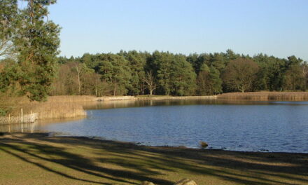
2. At a well defined fork in the path bear left and leave the North Downs Way. In 100yds at a crossing track you should turn left and maintain direction along this path and press on ahead as it changes into a cart track. No further instruction is needed until you reach a road. If you take the path to the right there is a picnic area, car park and view point with panoramic views over the countryside.(This is an alternative start point for the walk just off Suffield Lane, middle car park.)
3. Cross the road and pass by the front of Rodsall cottage. Turn left on the narrow path at the side of the garden. At the foot of a quite steep slope with two steps a wonderful almost subterranean path is met. Go right here to pass Rose Cottage and meet the outbuildings of Rodsall Manor. Press on ahead and pass the beautifully mellow sandstone galleted frontage of the manor house and turn left on a stony path immediately at the end of the garden. Soon the route enters majestic woodland and climbs a slope to meet a T junction by a post.
4. At this T junction turn left and continue up the slope. Just before the summit is reached the path joins a farm track. Turn left along the track as it now follows the edge of fields and later narrows. Fine views across the valley will be seen from parts of this path. Finally after going downhill and joining a farm track we pass the exceptional farmhouse of Lydling Farm and its perfectly restored barn, now finding new use as offices. (If you wish to make a detour here and turn right down the road the village of Shackleford has a pub, the Cyder House, which serves food).
5. Keep ahead to reach a lane beside a lily covered pond. Turn left along the lane and ignore a footpath with stile and gate to your left on a bend. Just before a second bend in the road bear left over a stile beside a field gate and press on ahead through a field. Keep to the left side of this field to reach a stile in the left corner at the top of a steep rise ahead of you. Cross the stile and now look towards a line of oak trees on top of the next ridge. Aim for the tree on the left end of the line and cross the stile beneath it. Maintain direction ahead along the left-hand edge of the field. Cross two further stiles in quick succession and continue along a fenced path. Cross a further stile and keep ahead, now with the wonderful 1760s Palladian frontage of the privately owned Puttenham Priory in view. Finally cross a stile and ahead along the lane for a few yards to return to the Good Intent.

DISTANCE: 4.5 miles
OS MAP: Landranger 186
GRID REFERENCE: SU 933478
GETTING THERE: Puttenham is close to the A31 Hogs Back, just off the B3000. Parking is on the roadside in the village, albeit limited, so you might prefer to park at Puttenham Common top car park just off Suffield Lane, between Puttenham and Elstead. If you do, start the walk from point 3.
REFRESHMENTS: The Good Intent Public House in Puttenham is conveniently located at the beginning of the route. The Cider House in Shackleford is a slight detour from the route but offers good food.
This walk is a Surrey Hills AONB walk and used with kind permsision. The Surrey Hills Area of Outstanding Natural Beauty offers some of South East Englands most beautiful and accessible countryside. Visit www. surreyhills.org for more information.


