This National Trust walk is over pretty Sussex Downland, through woodland, and across fields. Begins at the footpath leading past and behind Singleton cricket pavilion – a dark brown barn reached from a small lane to the West of the A286 as it enters Singleton from the south, on the opposite side of the road to the Partridge Inn and the Open Air Museum. Much of this trail follows white ‘permissive path’ arrows on waymarker posts.
1. From behind the cricket pavilion go over a stile, along the edge of a field, turn right over a second stile, and cross a stream bed using the plank bridge. Enter Drovers Estate over the stile beside the National Trust omega sign and follow the way up between the ancient hedgerows, through which curl great loops of Old Man’s Beard (wild clematis). Turn right at the top, after passing between the red brick walls of an old railway bridge. The disused line in the cutting below operated between Midhurst and Chichester, locally serving Goodwood racecourse. Opened in 1881, the last service ran in 1953 – a short lifespan for a vast amount of engineering and digging! The disused railway tunnels are now legally protected roost sites for bats.
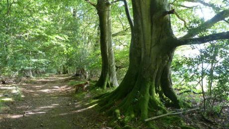
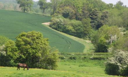
2. With the cutting to your right, go through the stile. Above to your left is Hat Hill, an area of unspoiled flower-rich chalk grassland – just what the South Downs is famed for. Follow the path to a waymarker post, continue slightly left and uphill to the woods. The track winds gently up beneath two ancient beech trees on a mossy, root-bound bank to your left, then past another great beech further along to your right. At the top, where Honeycomb Copse becomes more open, you pass a field gate and stile into pasture. Head diagonally across towards the gate and stile near the barn. Once past the barn, go over the stile to your left where a white marker post points across a field. Head straight across towards the centre of Rook Wood, with a view up to your right horizon of the white tented canopies of the Goodwood racecourse stands
3. A few metres right of an internal corner of the fence, go over the stile into the shady woods. In ten metres or so bear left along a moss-edged way through open beech woodland and enjoy its stillness and leaf-green light. Under sweeping boughs at the wood’s edge go across an open downhill ride, slightly right into a path into the further woods. Follow this downhill to the end of the track, turn right again, stroll down to then cross the busy A286
4. Once safely across by the bus-stop, follow the surfaced lane, then at the marker post turn left, keeping the hedge to your left along 100 metres of rutted track into Nightingale Wood. Look forward and to your right for the white-arrowed (permissive path) posts taking you right, then left up a narrow path. Follow this as it bears left and then turn right at the end. When you reach the main track turn left and head down into the beech wood. In spring look out for early purple orchids. When you reach the end, turn right and follow the bridleway track up a steady incline. Turn left and follow the line of old trees.
5. Continue past the farm and up the track which winds round the hill. (The large waymarker post at the top pays tribute to the longest fox chase ever recorded, over 50 miles which ended in horses dead from exhaustion. The fox was finally caught in Charlton, just a few miles from here.) Turn right and go through the gate with the sweeping hill reaching in front of you. Embrace the wind and follow a path to the left of the grassy field which leads up to the trees along the edge of the field. Here you will find a little gateway along the woodland edge which takes you into a twisting tunnel of trees and dense scrub. The pathway is narrow and on a steep hillside so take care
6. You’re now in Levin Down – a Sussex Wildlife Trust site, and a botanical utopia for chalk grassland wildflowers, rich with scrub for summer birds. When you reach the signboard, if you’ve had enough, head down to the road and turn right back into Singleton. Otherwise, enjoy the last glorious blast up along the side of the hill – it’s not much further! The last gate leads you into a juniper grotto – a few refuges of Junipers (a very early coloniser after the last Ice Age) still exist in sheltered spots on the Downs. When you leave Levin Down if you look over the hillside you can see across to Hat Hill where you started the walk (the hill with the tallest pylon on top). Follow the path down into Singleton village where you pop out at the primary school. If you turn right you will find the Partridge Inn.
DISTANCE: 4.75 miles
OS MAPS: Explorer 120
STARTING POINT: Starts behind the cricket pavillion, Singleton.
TERRAIN: Open Downland, woodland, and fields – some of the paths go across fields under cultivation, and there are stiles; so the walk is unsuitable for wheelchairs or buggies.


