
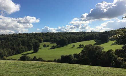
This walk has very little in the way of ups and downs and passes over downs and through pretty woods and fields. The walk was submitted by Guildford Rambling Club (see guildfordramblingclub.org.uk).
1. Cross the green and the A283 and enter the road signed to Grayswood. After a few yards take a signed footpath off to the left. Arrive at the back of the cemetery. Head across and up the field behind it. Emerge on a road between houses. Walk on and, where the road turns sharp right, head straight on along a footpath by the side of a house (‘The Downs’) to emerge on the green expanse of The Downs. Continue on, ignoring an immediate path left and down, going straight on and ignoring a cross path. After about 750 yards, cross the drive of an isolated house and enter a field. Head up to the far right-hand corner and out onto a road.
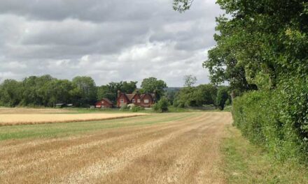
2. Go right and up a little hill. Just over the top and just past a house, take a footpath heading left. Enter a field and, presented with two arrows, one left and one forward, go straight forward across the field. Cross a deep track (negotiating two stiles). Head straight across to a stile in the right-angled corner of a hedge. Keep left in the next field. Cross another, smaller, field and emerge on a drive. Cross and follow the signs around behind a house and out onto Prestwick Lane. Turn left. Walk on for about 300 yards. Ignore the first footpath left, through High Prestwick Farm. Instead take the second footpath left. Follow this along the edge of a garden, through a field to a double gate, down a field on its right-hand side to take a stile out right and along the bottom of another field and exit left at a cross paths.
3. Go straight across and along a corridor to reach a T junction with a wide track (with a small sewage farm to your left). Walk right, cross Prestwick Lane and enter Lower Road in Grayswood. Walk up until you are at the starting edge of the green. Take the footpath off left, next to ‘The Mount’ street sign. Follow it up, emerging on the A286 opposite the Wheatsheaf Inn. Cross, go left a few yards past the pub and enter an un-named road heading right. About 100 yards down here, before reaching the houses, take a footpath off right. Follow this to cross a railway line. At a junction beyond it, turn left, heading roughly south-west. At an isolated stile (not connected to any fences) go right and up the path between banks. Emerge in a field with Keffolds Farm up to your right. The path traverses around to a gate at a T junction. Go left. After an iron gate ignore a left fork and take a right fork, up. Ignore lefts until a fork where you take the left fork following a yellow arrow.
4. Reach a lane, turn right and enter Weycombe Road, at a bend. Turn left and walk along this road for about half a mile until turning down the last side street on the left before the T junction at the end of the road. Walk by the side of a small cemetery into a Close and out on a footpath that takes you to a railway bridge. Go left to cross the bridge and immediately take a footpath right, up “Pathfields”. Follow this along past houses until it jinks right and emerges in the Chestnut Avenue car park in Haslemere. Cross to the far left corner, exit out into West Street and turn left to walk to the centre of Haslemere. There are cafes and pubs or you could picnic at the point where the walk will restart. To reach the picnic area (and restart point) cross the road that runs through the centre of the shops and go left. After about 100 yards turn right into Well Lane and walk to its end, passing the old town well. Turn right onto a grassy area with benches.
5. Restarting, continue right, past the benches then down the slope and out and across a field to join a track, Collards Lane. Follow this to the left and pass an NT warden’s hut to enter and cross a field. In the next field go half-left, cross a little footbridge and a cross track to enter a wood. Ignore cross paths, follow the signs through to a field, over another little footbridge, another field and another footbridge into another field. Here, turn left and follow the left-hand edge. Exit onto a track. Walk a little way to take a footpath out left. Emerge next to Holdfast Cottage on Prestwick Lane. Cross and turn right into the Private Road to Imbhams Farm. Walk on past farm buildings to reach a lake. Ignore the first signpost right, go around the end of the lake and take the next right (roughly east-north-east). After a 100 yards enter a field and turn left through a gap into the next field. Now turn right and walk through the eastern edge of Frillinghurst Wood.
6. Reach a white arrow and soon afterwards, fork right. Keep following the main path to a T junction where you turn right. Cross a footbridge and climb a slope. Ignore a left and go over a stile into a field. Ignore an immediate right, instead head for the far side and a stile mid-way along the fence. Go half-left across the next field, to the left of the farm buildings, to reach a concrete track. Go right. The track becomes a lane. Follow this to T junction with a road. Go left and pass Dell Farm. Stay on the road to pass ‘Furzefield’ and, just beyond it, take a footpath right. Walk along in the edge of a wood. At a signpost with blue and yellow arrows, go straight ahead, following the blue arrow. Reach a road by the gate to “Hollyhurst” and continue on along it to meet Mill Lane and continue straight ahead.
7. Walk along here until, opposite what was, until recently, a Ukrainian Care Home, take a footpath left, at first in the drive of a house but then bypassing its garage. Enter a wood, fork right and pass a lake. Climb up to emerge on The Downs. Your path meets the path that you took this morning and you turn right to retrace your steps through to Chiddingfold.

DISTANCE: 9.75 miles
OS MAPS: Explorer 134 Crawley & Horsham, Cranleigh & Billingshurst
STARTING POINT: The Green at Chiddingfold
GRID REFERENCE: 54 961 1 354
REFRESHMENTS: The Crown Inn, Chiddingfold (01428 682255), The Swan Inn, Chiddingfold (01428 684688), the Wheatsheaf Inn, Grayswood (01428 644440) and various places in Haslemere.
Image: St. Mary’s Church in Chiddingfold by Ben Gamble


