
At 965 feet (294m) Leith Hill is not only the highest point in Surrey but also the highest in south east England. It is a magnificent viewpoint, one of a series that crowns the well-wooded greensand ridge a few miles south of the North Downs. This walk is mostly through the lovely pine and beech woods and over areas of sandy heathland that is characteristic of greensand country, and although fairly hilly in places it is relatively undemanding. However, do follow the route instructions carefully; the large number of tracks and paths in this area, much of which are owned by the National Trust, can be confusing at times.
Begin by taking a path that leads up from the car park, following the first of a series of signs with a tower symbol on them, towards Leith Hill Tower. At a track turn right to head quite steeply uphill. Bear left in front of a gate marked ‘Bridleway’ at a junction and climb again to reach Leith Hill Tower. This was built in 1766 by Richard Hull of nearby Leith Hill Place to compensate for the hill just failing to top the 1,000ft mark; the extra height pushes it to 1,029ft. There is a small admission charge to the tower, from where there is one of the finest and most extensive panoramas in the south east: northwards across to the North Downs and beyond that to London and the Chilterns, and southwards over the Weald to the South Downs and the English Channel.
Just past the tower the path forks. Take the right-hand path here, at a second fork take the left-hand one and at a third fork take the left-hand one again. Shortly after, a well-defined path joins from the left. Continue ahead for about ½ mile, following the straight main path across Wotton Common to reach a crosstrack. Turn right here along a fairly straight path and after ½ mile bear left at a T‑junction to a lane. Turn left and almost immediately turn right, at a public footpath sign, along a path that keeps along the inside edge of woodland, with a fence on the right.
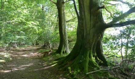
On the edge of the woodland go through a kissing gate and follow a path across a field to go through another kissing gate at the far end. Continue along an enclosed path to the right of houses, soon re-entering woodland, and descend, by an old wire fence on the left, to a crossroads. Turn right along a track that winds through the beautiful woodlands of Abinger Bottom, briefly emerging from the trees to reach a lane. Keep ahead along the lane and opposite the drive to a house called St Johns bear right to continue along a wooded track. After passing a barrier the track becomes a tarmac lane, which you follow through the charming and secluded hamlet of Friday Street to a T-junction passing the Stephan Langton pub.
Turn right to pass across the end of the millpond, a former hammer pond and one of many in the area that were created to power the hammers of the local ironworks up to the time of the Industrial Revolution. The view across it nowadays could hardly be more tranquil. On the far side, turn half right, at a public footpath sign, along a path that heads uphill away from the pond, passing to the left of a National Trust sign for Severells Copse, and continue steadily uphill to a lane. Cross over, keeping ahead to cross another lane and continue along the path in front. Take the right-hand path at a fork – not easy to spot – and head downhill along a sunken path, bearing slightly right on meeting another path to continue downhill, curving left to a lane.
Turn left through Broadmoor, another attractive and secluded hamlet, and opposite a riding centre turn sharp right, at Greensand Way and public bridleway waymarks, onto a track. Keep on this straight and broad track through Broadmoor Bottom for one mile and, 700 yards after passing to the right of Warren Farm, look out for a crossing of paths and tracks by a bench. Turn half left here onto a path; after a few yards cross a stream, by a National Trust sign for Duke’s Warren, and a few yards further on at a fork take the right-hand path. This is a most delightful part of the walk, initially between woodland on the right and more open sloping heathland dotted with trees on the left. Later the path re-enters woodland and heads steadily uphill, finally curving left to a junction.
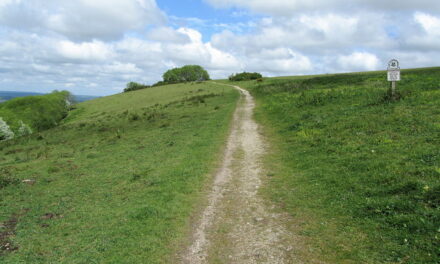
Bear left for a few yards to a fork and take the right-hand track, following the direction of a blue waymark and pass through a gate to leave Dukes Warren to emerge alongside the right-hand edge of the cricket pitch on Coldharbour Common. Just after the cricket pavilion turn half right at a National Trust information board along a path with a green wooden post signposted ‘Coldharbour Walk’. Ignore all side turns and follow the green waymarkers all the while. To the left there are grand views over the Weald to the South Downs on the horizon. Opposite a barrier on the right, turn left to re-join the outward route and head downhill back to Landslip car park.

Map above © Crown copyright Ordnance Survey Media 006/20.
DISTANCE: 6.5 miles
OS MAPS: Landranger 187 (Dorking & Reigate), Explorer 146 (Dorking, Box Hill & Reigate)
START GRID REFERENCE: TQ 147 432
STARTING POINT: Below Leith Hill, near Coldharbour village
REFRESHMENTS: The Stephan Langton pub in Friday Street (tel 01306 730775). Open for food Tuesday to Saturday 12pm-2.30pm and 6.30pm- 9.30pm. Sunday 12pm-4pm. Monday am closed but open at 5.30pm for drinks. Booking advisable.
The walk is taken from the Pathfinder Guide to Surrey, published by Crimson Publishing at £11.99. www.crimsonpublishing.co.uk.
Leith Hill Tower (Peter Pearson)


